Friday, July 23, 2010

Cedar Creek Sesh

The season at Cedar Creek is in full swing. With hot temps in the valleys, Cedar Creek is the perfect place to beat the heat. The Elephant's Perch (climbing shop) in Ketchum donated some hardware for the area and in turn I gave them a topo for the crag. There have been a few folks visiting the area, sampling some of the best limestone around. There are still a number of routes to establish, especially on the easy to moderate side of things, and I plan on finishing development here before moving on to the next crag.

Conditions at the trailhead have dried out considerably in the last two weeks, with most of the wildflowers having gone to seed. I was fortunate enough on my last two visits to catch the Bitterroot flowers in bloom! These little guys are my favorite and I have coined the name "dirt lotus" to describe their stark beauty.

We had a good session yesterday with three(!) cars in the parking lot and several parties enjoying the quality stone and nice temps at the crag. Here's Conan on one of the warm ups, "Little Dark Cloud". Afterwards we moved to the other end of the crag where angle kicks back to the better side vertical and hopped on my project. I had bolted this line earlier this year and had given it a couple redpoint burns. It's characterized by a steep, bouldery start with really long pulls between descent holds. The last time I had climbed it, things felt a little desperate, and I was having trouble clipping. With that attempt fresh in my memory, I got on it yesterday with no expectations. Before I knew it, I had climbed past my previous high point and was feeling great! Near the top I didn't have my beta totally dialed in, and when trying a long deadpoint to an edge I missed, but managed to snag a sloper instead. Giving out the war cry, I hung on, popped to another sloper and pulled through! What a pleasant surprise - Sending when you least expect it! And, it felt easy, especially compared to my previous attempt. Isn't that how it should feel when you send?

I named the route "Caught on Tape" in reference to a joke I had about placing a surveillance camera on a tree to see who was climbing my projects with out permission. I've never been one to use red tape on the first bolt, and figure at a place like Cedar Creek or the Fins, most people know what's a project and what's not, and whose it is. Because I was leaving draws on the routes, I think folks were hopping on them for the low commitment factor. I really don't mind, and like Dave Bingham, I believe that the route is a product of the person who put the time, money and effort in to bolting and cleaning it, not necessarily the one who gets the first ascent. Well, now the route is fair game and ready for everyone to enjoy! Like the other routes on that wall, it's 5.12, somewhere in the b/c area.

After sending "Caught on Tape", Conan and I sampled one of Lucas's 5.12s, "34/24" and enjoyed steep climbing on juggy holds until the crux: a cryptic sequence on smaller, slopey holds with a slabby finish. Looks like I've got another project to redpoint at the Creek!

With evening rolling in, I said farewell to friends and boogied to the car in record time to begin the drive home. The Lost Rivers deliver once again! Thank You.

Dog is my co-pilot... Kaya keeps an eye on the road while I scope the crags!

Monday, July 19, 2010

Wildhorse Revisited

Wolf, stoked upon entering the alpine cirque above Wildhorse Mines.

Last week my good friend and neighbor, Wolf Riehle and I returned to the alpine cirque above the Wildhorse Mine for two days of alpine adventures. We got an early start Tuesday morning and hiked in to established camp at lake 9238'. Our agenda for the first day was to climb the impressive stepped ridge of peak 11,108'. I had spotted this dramatic line when Drew and I climbed Sky Pilot the week before and was eager to give it a try.

Peak 11,108' - Step n' Wolf climbs the obvious stepped ridge/arete.

After pitching our tent and dropping our overnight gear Wolf and I headed for the route. The stepped ridge was our main objective, but wanting to climb rather than scramble over scree, we went for lowest point of climbable rock at 9600' and began roped climbing. The rock was well featured, of good quality and took gear reasonably well. I headed for the middle rib, which after 5 pitches took us to the base of the first step.

The summit blocks of the first step looked steep and imposing, but we managed to find a way up the north east arete, pulling a few 5.7 - 5.8 moves. We continued along the ridge crest, short roping and short pitching when things got steep until we reached the third step. From below there is an obvious left facing corner that overlooks the lakes and I was keen to give this a try. A short traverse led into the bottom of the corner and 5.7 moves up relatively good rock for 60' brought us to the top of the third step. A bit more short roping brought us to the actual crux of the route, the forth step - the longest and steepest of them all.

Wolf cruising the corner pitch of the third step.

The rock was well featured but slightly deteriorating in quality. My biggest concern was whether I would be able to get gear or not. I set off again climbing the north east arete of this headwall feature, finding descent pro and easy climbing. About a quarter of the way up the route things began to change: the cracks were either flared or seams and gear became harder and harder to find. In addition the angle steepened and there were a few loose holds. Fifteen feet above my last piece I could see features above that might take gear. I renewed my focus, took a breath and lead out in a sequence of 5.8 moves on questionable rock. Finally reaching a small stance way out from my last piece I placed a marginal cam and took another deep breath. The climbing above looked easier but the rock was more broken. I continued on, gently pulling down on holds rather than out and soon topped out on the forth step. Wolf easily cleaned the pitch and we high fived on the summit. Another first ascent(?) in the Wildhorse Basin, "Step n' Wolf" is grade III, 5.8 R and from our start about 1500' of climbing.

Step n' Wolf III, 5.8 R

After enjoying some food and water on the summit, we descended easily to the southwest and were back in camp in an hour. A quick dip in the lake, an evening meal and a spectacular display of light on the peaks ended a fantastic day.


The next morning we were up at dawn for breakfast and cappuccinos then shouldered our packs for the 5 minute approach to Sky Pilot. Quite a bit of snow had melted since Drew and I climbed it. Wolf and I were able to avoid snow completely on the approach and climb the route in our approach shoes. Knowing the line and having a solid partnership, Wolf and I made great time on this 2000' climb, summiting in 4 1/2 hours. We enjoyed clean rock and great exposure on this alpine ridge at upper elevation.

Mid route on Sky Pilot.

Sky Pilot III, 5.6-5.8

We basked in the sun on top and signed the summit register. This descent is a touch more complicated than Step n' Wolf; not having our alpine boots we avoided firm snow and stuck to the talus and boulders. Having a camp in the adjacent drainage meant that we'd needed to return to retrieve our gear. This task was not so easy, as the entire north face of peak 11,280 (Sky Pilot) is steep rock and snow couloirs. While climbing yesterday's route I spotted a weakness down the ridge where the cliffs gave way to steep trees and vegetation. A long traverse around the east ridge brought us into back in to our intended cirque where we navigated game trails ad-mist steep terrain and short cliffs. Soon we were back at camp and couldn't resist another dip in the lake's icy waters!

Coffee and a ciggy on the summit! So Euro!

After a quick pack, Wolf and I descended to our car at the mine and returned to Ketchum for a feast in town. Thanks for an amazing trip, Wolf!


Wednesday, July 7, 2010

Sky Pilot, III 5.8 Wildhorse Creek

Sky Pilot climbs the obvious sun/shade arete to the summit of 11,280'.

With a day off from guding and neglecting duties around the home, Drew and I headed into Wildhorse Creek to do some climbing on a feature I had only seen on a topo and Google Earth. Since taking the Alpine Course this spring, I have been trying to climb as many alpine routes as possible as well as develop strength with sport climbing. Drew had been into the north face of Brietenbach a few days before with our fellow guide Clark and got turned around by poor rock and a lack of protection. Wanting to do something big and alpine, but not wanting to drive all the way to the East Fork of the Pahsimeroi to get shut down, we settled on Wildhorse.

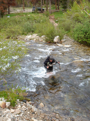
We met in the wee hours and drove into Wildhorse Creek to the Wildhorse Mine. On the drive in we could see what was once the bridge crossing the creek about 100 yards down stream from the mine. There's nothing that will wake you up more than fording icy waters first thing in the morning!


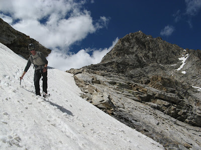
Our intended route climbed above one of the Wildhorse Lakes at 9200'. We made quick time hiking into the upper basin and were in awe of the alpine topography hidden from view of Wildhorse Creek road. We put harnesses and helmets on at the lake, pulled out our axes and booted up a steep snow slope to access the rock. A ledge system cuts through the lower cliff band and brought us to the base of the ridge/arete, where we roped up and began climbing. Our system was a mixture of simul-climbing with Tiblocs and pitching it out when things got steeper. Initially we wrapped around to the right (north) side of the ridge to avoid vertical rock. Then a few short pitches brought us back to the arete, which we climbed for the next 1500' or so to the summit. Like so many other ridge/arete routes in the Pios (Broken Arrow on Mustang Peak, and the North East Ridge of Devils Bedstead West) the climbing was generally easy on good rock with fantastic exposure! The great thing about this route was it's length: basically 2000' feet of technical climbing brings you to the unnamed summit of 11,280'.

The ledge accessing the upper basin and the base of the route.


Gettin' some in alpine boots!


Drew making short work of one of the 5.6 sections high on the route.

Great exposure at 11,000' near the summit!

After some lunch on the summit and hanging out with the Ladybugs, we descended to the southwest into the adjacent basin, below the impressive face of Goat Peak. Fortunately there was still some snow and plunge stepping was much easier than navigating steep scree and cliffs. Once back at treeline we spooked a herd of elk hanging out in the lush alpine meadows getting fat on summer's greenery. We dropped back down into Wildhorse Creek and returned to the mine for another cold creek crossing on sore feet. What a great day in the alpine!


Messaging sore feet with Mustang Peak in the background.


Drew and I decided to name the route Sky Pilot, after the aromatic alpine flower found on ledges and cracks the entire way. We gave the route a grade III for commitment level due to it's length of technical climbing on the ascent. We felt like what we climbed was probably 5.8 based upon a steep but short finger crack pitch I led near the top, but that could easily have been bypassed. There were several short pitches of 5.6 climbing with lots and lots of easy fifth and forth class in between.

Thursday, July 1, 2010

Spring to Summer

As guiding season starts to pick up, I have less time to go cragging. Between trips in to the mountains I've been trying to make the most of what little time I have by spending some half days at Cedar Creek and mountain biking with Aki. We've done couple great rides this spring/summer, the best being Elk Mountain (meadows?) Loop out of Stanley Lake. I haven't been on single track that good in a while! I'm hoping to get a chest harness for the GoPro Cam and post some footage here soon. Thanks Aki for getting me back on a bike!


The cool temperatures this spring have kept some ice around at the base of Cedar Creek, but all routes are climbable and I've managed to tick a few projects that last couple times I've been there. First to go down was "The Town Bike" (as in everyone takes 'er for a ride - a reference to the route seeing lots of traffic prior to being completed). Although it needs consensus, I'd say it's a solid 12, somewhere in the 12b/c range. The route is characterized by sustained climbing on good holds with a crux near the top, right about when the pump clock starts to ring!

Here are a couple bad pics of The Town Bike.

Next was "The Jewel Thief", a 12a just to the left of The Town Bike. The name is a reference to the route being climbed without consent when it was still a project. I can't be too upset though, the strong fellow onsighted it!!! This is a great route up steep rock with good holds and big, pumpy moves. Go for the onsight!

The next project is just left again on the same wall and is most likely the hardest of the three. It's got some big moves but generally climbs smaller holds. To me it feels like 12c, but consensus will determine that. I hope to send next visit.
A wide angle shot of Cedar Creek. It doesn't show much, but the Town Bike and others are on the far left side of the wall.

In between guided trips and cragging, Drew and I managed a climb up the East Ridge of Williams Peak last weekend. We were hoping to find a nice alpine ridge route to the summit, but steep, somewhat loose rock push us into some gullies south of the ridge proper. Drew was kind enough to let me "mock" guide him to the top, and we had some good laughs roped together along the way. It was great short roping and short pitching practice with quite a bit of firm snow in the morning. Thanks Drew! Next time we'll try the ridge direct!


On Tuesday I did a guided Finger of Fate climb and we managed to thread the needle with the weather quite nicely. It sprinkled a bit on the hike in and threatened while we were on the route, but it never cut loose until the drive home. From the summit we could see showers in the Sawtooth Valley and dark clouds to the west, but we felt blessed to not get wet on the climb. There was quite a bit of snow still in the upper basin and even a little bit of ice packed in the corners of the route. My client Rob pretty much hiked the route and we had no problems avoiding the ice and wet rock. A few sprinkles on the hike out kept the temps cool and the mosquitos at bay. Thanks for great day in the Alpine Rob!

Leaving the snow and on to the rock, pitch 1.

The Open Book, pitch 2.

The "ski tracks" on the upper part of the climb. Does it get any better?

Thats about all I have for now. Look for more Cedar Creek sends, reports from guided adventures and hopefully some mountain bike footage soon.

Cheers, Marc